
Welcome to
Chios Hiking
WORRY LESS
HIKE MORE
Ξεκινήσαμε τρεις, πορευτήκαμε δύο και κάποια στιγμή έμεινα μόνος. Σήμερα ούτε εμείς οι ίδιοι γνωρίζουμε πόσοι πραγματικά είμαστε στο Chios Hiking.
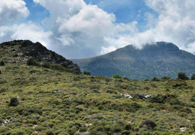
Αυτό που δεν έχει αλλάξει είναι η αγάπη για τα βουνά, τα τοπία της υπαίθρου και τα μονοπάτια.
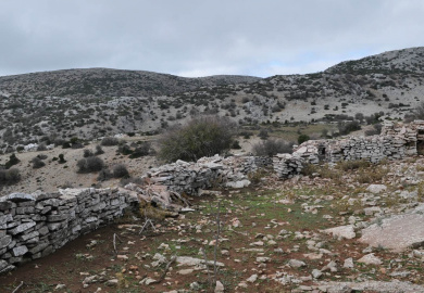
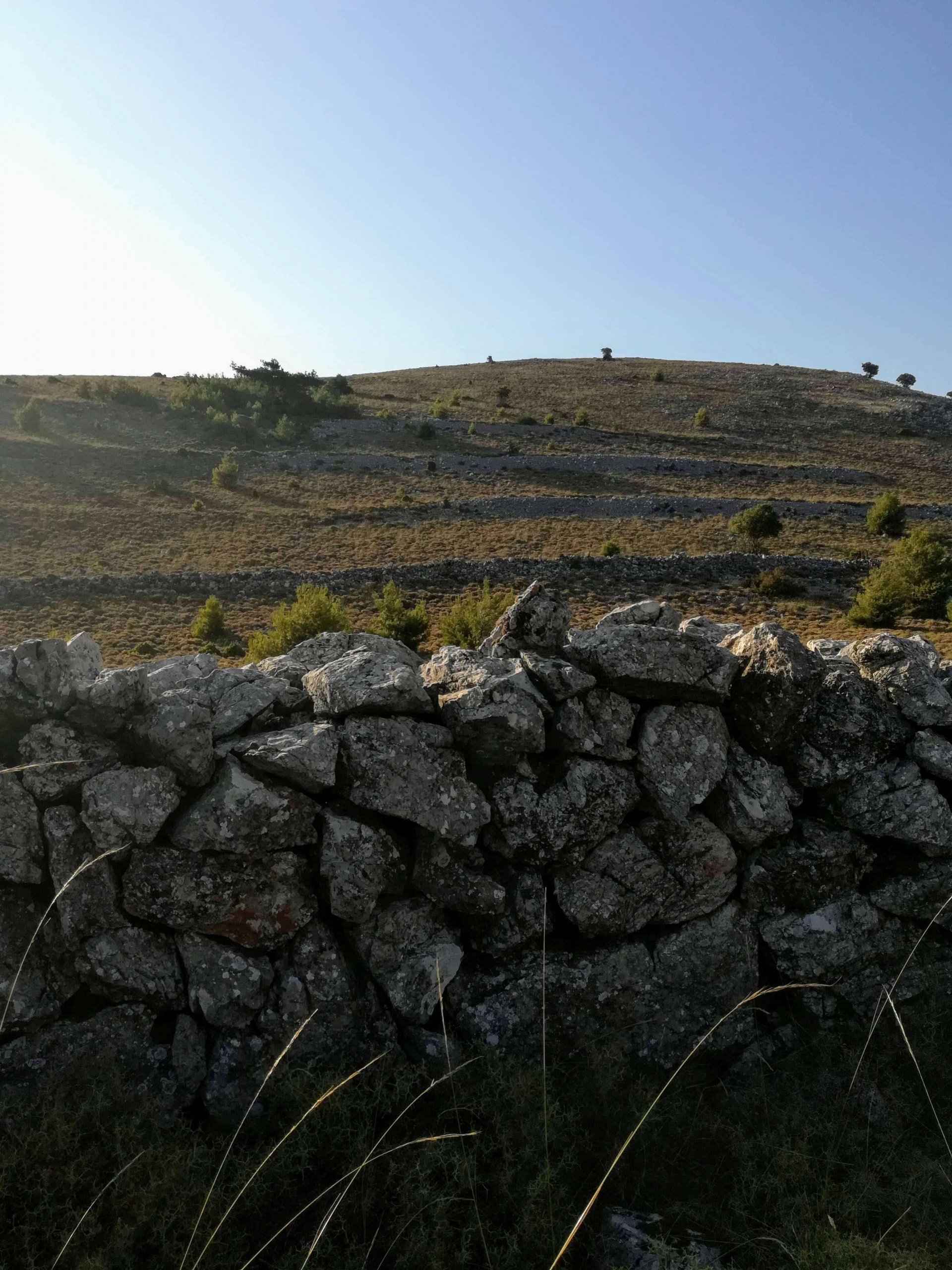
Λατρεύουμε την ομίχλη, τις ξερολιθιές, τις ιστορίες των παππούδων στα καφενεία των χωριών και τη μυρωδιά του αχνιστού ψωμιού που μόλις βγήκε από τον ξυλόφουρνο.
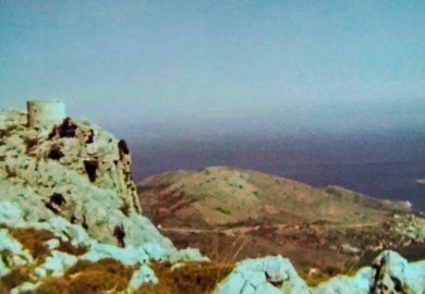
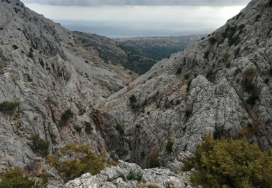
Στη Χίο υπάρχουν επιλογές για όλους. Οργανώστε τη δικιά σας πεζοπορία
ή απευθυνθείτε σε ομάδες όπως το Chios Hiking για expert καθοδήγηση.
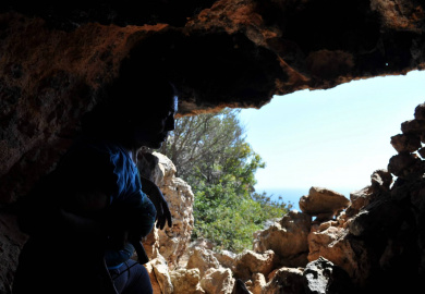
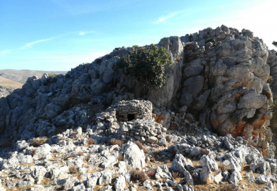
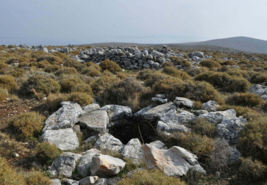
Στη Χίο περπατήστε το νότιο τμήμα μέχρι το Μοναστήρι της Νέας Μονής […]
Περισσότερες διαδρομές μπορείτε να πραγματοποιήσετε με την πεζοπορική ομάδα Chios Hiking.

Στη Χίο περπατήστε το νότιο τμήμα
μέχρι το Μοναστήρι της Νέας Μονής […]
Περισσότερες διαδρομές μπορείτε να πραγματοποιήσετε
με την πεζοπορική ομάδα Chios Hiking.

Στη Χίο υπάρχουν επιλογές για όλους.
Οργανώστε τη δικιά σας πεζοπορία
ή απευθυνθείτε σε ομάδες όπως
το Chios Hiking για expert καθοδήγηση.
our tips for
Beginners
Όπως κάθε δραστηριότητα στην ύπαιθρο, έτσι και η πεζοπορία έχει τους δικούς της κανόνες που σκοπό έχουν τόσο την προστασία των περιπατητών και των ορειβατών, όσο και τη μείωση του περιβαλλοντικού αποτυπώματος.
Αν είστε έμπειροι πεζοπόροι, τότε πιθανώς τα παρακάτω σας είναι ήδη γνωστά. Αν όμως τώρα αρχίζετε να ανακαλύπτετε την ομορφιά της πεζοπορίας, οι συμβουλές που ακολουθούν θα σας φανούν χρήσιμες. Είστε έτοιμοι να κάνετε το πρώτο βήμα;
Πως να επιλέξετε διαδρομή
Η επιλογή του κατάλληλου μονοπατιού δεν είναι τόσο απλή διαδικασία όπως ακούγεται και συχνά προκαλεί σύγχυση τόσο σε αρχάριους, όσο και σε έμπειρους πεζοπόρους. Είναι διάφοροι παράγοντες που μπορεί να επηρεάσουν την έκβαση μιας πεζοπορίας. Αν απαντήσετε με ρεαλισμό τις παρακάτω ερωτήσεις, τότε έχετε πολλές πιθανότητες να διαλέξετε ένα μονοπάτι που θα ταιριάζει με τις επιθυμίες και τις δυνατότητές σας και δεν θα σας οδηγήσει σε περιπέτειες:
- Ποια είναι η πεζοπορική εμπειρία και ποιες οι επιδεξιότητες της παρέας;
- Πόσο χρόνο έχετε στη διάθεσή σας;
- Ποια είναι η υψομετρική διαφορά, το μήκος και το επίπεδο δυσκολίας των υποψήφιων μονοπατιών;
- Επιθυμείτε η διαδρομή να έχει σήμανση ή έχετε την ικανότητα να κινηθείτε και σε μη ευδιάκριτα μονοπάτια;
- Σε τι είδους τοπία θέλετε να περιπλανηθείτε;
- Ποιες προβλέπεται να είναι οι καιρικές συνθήκες;
- Πως θα φτάσετε στο μονοπάτι και πως θα επιστρέψετε πίσω;
Μην ξεχάσετε
Υπάρχουν αμέτρητες επιλογές πεζοπορικού εξοπλισμού στα εξειδικευμένα καταστήματα, που μπορούν να κάνουν τις εξορμήσεις σας στο βουνό και πιο ευχάριστες και πιο ασφαλείς. Αν δεν θέλετε να ξοδέψετε μια περιουσία σε αγορές πεζοπορικών ειδών, ξεκινήστε με τα βασικά και σιγά σιγά θα ανακαλύψετε μόνοι σας τα υπόλοιπα αξεσουάρ που χρειάζεστε.
- Παπούτσια. Ένα καλό πεζοπορικό παπούτσι είναι αδιαμφισβήτητα το προϊόν στο οποίο αξίζει να επενδύσετε περισσότερα χρήματα. Αν σκοπεύετε να ασχοληθείτε με την ορεινή πεζοπορία, προτιμήστε τα μποτάκια από τα χαμηλά παπούτσια, γιατί εξασφαλίζουν μεγαλύτερη ευστάθεια και μπορεί να σας γλιτώσουν από τραυματισμούς. Όσο πιο ελαφρά και εύκαμπτα είναι τόσο πιο ξεκούραστη θα είναι η βόλτα σας.
- Νερό. Αν και σχετικά βαρύ, το νερό είναι απαραίτητο στις πεζοπορίες γιατί αναπληρώνει αυτό που χάνει ο οργανισμός με τον ιδρώτα. 1,5 λίτρο είναι συνήθως αρκετό για μια μέτρια πεζοπορία το χειμώνα, αλλά το καλοκαίρι πιθανώς να χρειαστείτε διπλάσια ποσότητα. Να θυμάστε ότι είναι καλύτερο να σας περισσέψει νερό, από το να σας ληφθεί και πίνετε σε τακτά χρονικά διαστήματα και όχι απότομα.
- Ένδυση. Τα άνετα πεζοπορικά παντελόνια, οι μπλούζες που δεν κρατούν ιδρώτα, οι σωστές κάλτσες (όχι πολύ ζεστές, όχι πολύ λεπτές) και το κατάλληλο μπουφάν, θα κάνουν τις πεζοπορίες σας πιο ευχάριστες. Υπάρχουν αμέτρητες επιλογές. Καλό είναι να έχετε πάντα μαζί σας μία αδιάβροχη, αντιανεμική μεμβράνη γιατί ο καιρός στα βουνά είναι ευμετάβλητος χειμώνα καλοκαίρι.
- Κολατσιό. Σε κάθε πεζοπορία 1-2 διαλείμματα σε κατάλληλες θέσεις είναι επιβεβλημένα για να πάρετε μια ανάσα και να φάτε κάτι που θα αναπληρώσει τις χαμένες δυνάμεις. Μπάρες δημητριακών, παστελαριές, ανάλατοι ξηροί καρποί, φρούτα -κατά προτίμηση μπανάνες- είναι ελαφρά σνακ, δεν έχουν μεγάλο βάρος ή όγκο και θα σας δώσουν ενέργεια για να συνεχίσετε.
- Αξεσουάρ προσανατολισμού. Αν πηγαίνετε μόνοι στο βουνό, τότε θα πρέπει να έχετε μαζί σας είτε χάρτη και πυξίδα, είτε κάποια συσκευή προσανατολισμού. Πλέον όλα τα σύγχρονα κινητά τηλέφωνα διαθέτουν gps, αλλά αυτό προϋποθέτει ότι μέχρι το τέλος της πεζοπορίας το κινητό δεν θα σταματήσει λειτουργεί είτε λόγω μπαταρίας, είτε λόγω βλάβης.
- Προστασία από τον ήλιο. Σε περιοχές με μεγάλη ηλιοφάνεια όπως η Χίος, πρέπει θυμάστε ότι ο ήλιος ειδικά τους καλοκαιρινούς μήνες δεν αστειεύετε και μπορεί μετατρέψει μια εύκολη βόλτα, σε μια δυσάρεστη εμπειρία. Καπέλο με προστασία του αυχένα και αντιηλιακό (προσώπου – σώματος) μπορούν να κάνουν τις θερινές πεζοπορίες πιο ευχάριστες και να σας γλιτώσει από εγκαύματα μέχρι και ηλιάση.
- Σακίδιο. Το πεζοπορικό σακίδιο είναι απαραίτητο για κουβαλήσετε όλα όσα χρειάζεστε στις εξορμήσεις σας. Υπάρχουν διάφορα μεγέθη ανάλογα με τον τύπο και τη διάρκεια της πεζοπορίας. Συνήθως ένα σακίδιο 20 λίτρων είναι υπεραρκετό για τις καλοκαιρινές βόλτες σας, ενώ ίσως σας φανεί μικρό το χειμώνα που θα χρειαστεί να κουβαλήσετε περισσότερα ρούχα.
- Ασφάλεια. Οι πεζοπορίες όπως και όλες οι αθλητικές δραστηριότητες στην ύπαιθρο εγκυμονούν κινδύνους. Αν κινείστε μόνοι σας, καλό είναι να έχετε μαζί σας ένα μικρό φορητό φαρμακείο και βέβαια τις γνώσεις για να το χρησιμοποιήσετε. Για καλό και για κακό, υπενθυμίζουμε τα τηλέφωνα έκτακτης ανάγκης: Υπηρεσία Επικοινωνιών Εκτάκτου Ανάγκης 112, Πυροσβεστική Yπηρεσία 199, Ε.Κ.Α.Β. 166.
Μην το παρα(κάνετε)
Το μεγαλύτερο προσόν που πρέπει να έχουν οι πεζοπόροι για να μην βρεθούν σε δυσάρεστες καταστάσεις είναι ο αυτοέλεγχος. Μην αφήσετε το θυμικό να σας παρασύρει και ακολουθήστε τις παρακάτω συμβουλές για να κάνετε τις βόλτες σας στα βουνά ασφαλέστερες και απολαυστικότερες για εσάς και τους γύρω σας:
- Μην ξεπερνάτε τα όρια. Αδιαμφισβήτητα θα είναι ωραίο να ανέβειτε και στην επόμενη κορυφή, αλλά σίγουρα προλαβαίνετε να φτάσετε και να επιστρέψετε πριν νυχτώσει; Πάντα να σκέφτεστε τον χρόνο, τις αντοχές του πιο αδύναμου και το ενδεχόμενο κάτι να μην πάει καλά. Μην πηγαίνετε πεζοπορία μόνοι.
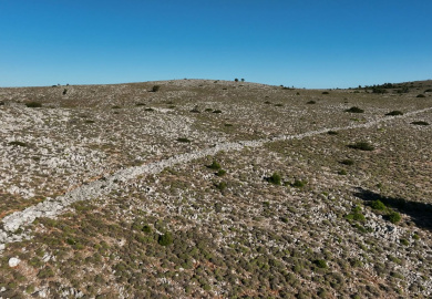
- Μην αφήνετε το μονοπάτι. Κάποιος λόγος υπάρχει που το μονοπάτι ακολουθεί τη συγκεκριμένη πορεία. Αν βγαίνεις εκτός του μονοπατιού ενδέχεται να χαθείτε, να ταλαιπωρηθείτε ή ακόμα και να τραυματιστείτε, ενώ σίγουρα έτσι θα προκαλέσετε μεγαλύτερη όχληση στο οικοσύστημα και θα συμβάλετε να σχηματιστούν πολλαπλές διαδρομές.
- Leave No Trace. Στις πεζοπορίες φροντίζουμε να ελαχιστοποιούμε το περιβαλλοντικό μας αποτύπωμα. Σεβόμαστε την άγρια ζωή και το τοπίο, δεν αφήνουμε σκουπίδια, δεν καταστρέφουμε μνημεία του παρελθόντος και γενικά προσπαθούμε ότι συναντάμε να το αφήνουμε όπως το βρήκαμε. Το μόνο που μπορείτε να πάρετε είναι φωτογραφίες και τυχόν απορρίμματα που “ξέπεσαν” από προηγούμενους.
- Δεν είστε μόνοι. Σε περίπτωση που στη διαδρομή σου συναντήσετε άλλους περιπατητές, να τους συμπεριφερθείτε όπως θα θέλατε να σας συμπεριφερθούν εκείνοι. Δεν ενοχλείτε, δεν κάνετε φασαρία και αυτονόητο είναι ότι βοηθάτε όποιον έχει ανάγκη. Να θυμάστε ότι σε στενά ή δύσβατα σημεία προτεραιότητα έχει αυτός που ανεβαίνει στο βουνό ή αυτός που βρίσκεται στην πιο κακοτράχαλη θέση.
